The C-MAP 4D Electronic Marine Charts represent the cutting edge in marine navigation technology, offering boaters a dynamic and flexible solution tailored to enhance their on-water experience. This digital chart system is unique in its capability to grow and adjust by incorporating new data and services as they emerge, ensuring mariners have access to the most up-to-date navigation information.
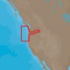
C-MAP 4D cartography is designed to be seamlessly integrated with select marine navigation equipment such as the Furuno 1670F/1870F plotters and Standard Horizon CPN 7000i/CPN1010i series. It provides comprehensive coverage of the nautical area extending from Cape Blanco in Oregon to the northern tip of Cape Flattery in Washington, a crucial corridor for both recreational and commercial mariners along the Pacific Northwest coastline.
Key features and benefits of C-MAP 4D include:
- Detailed marine charting for confident navigation
- Advanced navigation features like auto-routing, satellite imagery, and 3D views
- Continuous chart updates with ability to add and update data and services
- Seamless compatibility with Furuno and Standard Horizon units, among others
- Extensive coverage from Cape Blanco to Cape Flattery, crucial for boaters in this region
FAQs
What are the advanced navigation features offered by C-MAP 4D?
C-MAP 4D boasts a multitude of advanced navigation features like dynamic tides and currents predictions, high-resolution satellite imagery, and 3D views both above and below the waterline. Additional layers such as aerial photographs and high-resolution bathymetric charts (fishing charts) elevate situational awareness and augment safety for seafarers.
Can I add and update data and services to my C-MAP 4D?
Definitely, the C-MAP 4D platform is designed to be future-proof, allowing users to add and update their chart data with the newest releases. These updates include chart corrections, additional points of interest, and even enhanced features to keep your charting solution at the forefront of innovation.
Which units are compatible with C-MAP 4D?
Users will find that C-MAP 4D is compatible with an array of navigation systems, particularly the Furuno 1670F/1870F and Standard Horizon CPN 7000i/CPN1010i units. For boaters with these devices, upgrading to or utilizing C-MAP 4D charts will be virtually plug-and-play.
What is the coverage area of C-MAP 4D NA-D954?
The NA-D954 chart from C-MAP 4D efficiently covers the marine area from Cape Blanco, OR, to Cape Flattery, WA. This targeted coverage is indispensable for sailors and fishers operating along this segment of the United States' West Coast, ensuring they have accurate and comprehensive chart details for safe passage.







Mellissa –
Tarina –
Kaelyn –
Tavis –
Geena –