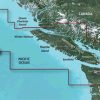
The Garmin VCA018R BlueChart g3 Vision HD is a navigation instrument that offers exceptional coverage, clarity, and detail in the coastal regions of Vancouver Island. This includes areas such as Juan de Fuca Strait, Johnstone Strait, Georgia Strait, Queen Charlotte Strait, Quatsino Sound, San Juan Islands, Fraser River to Chilliwack, Harrison Lake, Pitt Lake, Jervis Inlet, Bute Inlet, Knight Inlet, and the southern parts of Hecate Island. It also provides maps of ports in British Columbia, California, Port Angeles, Oak Harbor, Anacortes, and Bellingham in Washington, United States.
The device features an auto guiding tool that calculates a suggested path based on the user's specified depth and overhead clearance. The maps also have precise contours that accurately depict the bottom structure, making it ideal for fishing and cruising activities. Additionally, the high-resolution satellite imagery, combined with nautical charts, offers a realistic representation of the surroundings, making it particularly useful for approaching unfamiliar harbors or ports.
For a comprehensive view, the FishEye View and MarinerEye View display a three-dimensional picture of both above and below the waterline. This includes crystal-clear aerial imagery that provides detailed information about various ports, harbors, and marinas, making it perfect for accessing unknown ports.
It is important to note that while the Auto Guidance feature is helpful for planning purposes, it should not replace safe navigation techniques. Also, the product contains certain chemicals that are classified as potentially harmful and have been linked to cancer, birth defects, and reproductive damage in California. For more information, please refer to P65Warnings.ca.gov.
Frequently Asked Questions
1. What areas does the Garmin VCA018R BlueChart g3 Vision HD cover?
The Garmin VCA018R BlueChart g3 Vision HD covers the coastal regions of Vancouver Island, including areas such as Juan de Fuca Strait, Johnstone Strait, Georgia Strait, Queen Charlotte Strait, Quatsino Sound, San Juan Islands, Fraser River to Chilliwack, Harrison Lake, Pitt Lake, Jervis Inlet, Bute Inlet, Knight Inlet, and the southern parts of Hecate Island. It also provides maps of ports in British Columbia, California, Port Angeles, Oak Harbor, Anacortes, and Bellingham in Washington, United States.
2. What features does the Garmin VCA018R BlueChart g3 Vision HD have for fishing and cruising activities?
The Garmin VCA018R BlueChart g3 Vision HD has precise contours that accurately depict the bottom structure, making it ideal for fishing and cruising activities. It also features high-resolution satellite imagery and nautical charts, offering a realistic representation of the surroundings. Additionally, the FishEye View and MarinerEye View display a three-dimensional picture of both above and below the waterline, providing detailed information about various ports, harbors, and marinas.
3. Is the Auto Guidance feature a replacement for safe navigation techniques?
No, the Auto Guidance feature on the Garmin VCA018R BlueChart g3 Vision HD is a helpful planning tool but should not replace safe navigation techniques. It calculates a suggested path based on the user's specified depth and overhead clearance, but it is important to ensure safe navigation practices are followed while using the device.
4. Are there any potential health risks associated with the product?
Yes, the Garmin VCA018R BlueChart g3 Vision HD contains certain chemicals that are classified as potentially harmful and have been linked to cancer, birth defects, and reproductive damage in California. For more information, please refer to P65Warnings.ca.gov.



Tyeshia –
Kawika –
Ed –
Kecia –
Hong –