C-MAP 4D Electronic Marine Charts are a modern navigation solution that offers advanced features and the ability to add data and services as they become available. This adaptability makes C-MAP 4D the ideal choice for boaters.
The C-MAP 4D cartography is compatible with Furuno 1670F/1870F, as well as Standard CPN 7000i and CPN1010i units.
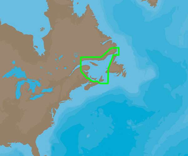
The NA-D936 Gulf of St. Lawrence coverage provides comprehensive charting of this area.
This chart offers more features and specifications that enhance your boating experience.
Frequently Asked Questions
Q: What makes C-MAP 4D an ideal choice for boaters?
A: C-MAP 4D offers advanced features and the ability to add data and services as they become available, making it adaptable to any boating needs.
Q: Which devices is the C-MAP 4D cartography compatible with?
A: The C-MAP 4D cartography is compatible with Furuno 1670F/1870F, as well as Standard CPN 7000i and CPN1010i units.
Q: What does the NA-D936 Gulf of St. Lawrence coverage provide?
A: The NA-D936 Gulf of St. Lawrence coverage provides comprehensive charting of the Gulf of St. Lawrence area.
Q: What additional features and specifications does this chart offer?
A: The C-MAP 4D Gulf of St. Lawrence – NA-D936 chart offers additional features and specifications that enhance your boating experience.




Anamarie –
Rhonda –
Tegan –