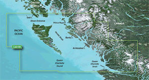
The Garmin VCA019R BlueChart g3 Vision HD is a handheld navigation device that includes extensive coverage of the British Columbia coast, Hecate Island, Queen Charlotte Sound, Dixon Entrance to Duke Island, FitzHugh Sound, Dean/Fisher Channel, Burke Channel, Whale Channel, Barrie Reach, Kitimat Arm, Grenville Channel, Portland Inlet to the Nass River, and Port Hardy, Kitimat, and Bella Bella. It features integrated Garmin and Navionics information, providing industry-leading coverage, clarity, and detail.
Auto Guidance technology swiftly determines a proposed path using necessary depth and overhead clearance. Depth Range Shading allows users to quickly see goal depth at a glance for up to ten depth ranges, while Shallow Water Shading provides shading at a user-specified depth. With detailed contours, this chart is perfect for fishing and provides more information on wetlands, canals, and port designs.
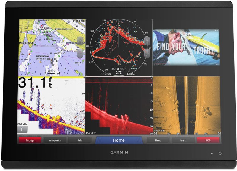
The charts also offer a realistic perspective of the surrounding areas with high-resolution satellite images with nautical chart overlays, which is perfect for approaching unknown harbors or ports. The Mariner Eye View gives a 3-D depiction of the surrounding region above and below the waterline, while the FishEye View provides a 3-D image of the bottom and contours viewed from below the waterline. Aerial photography with extraordinary clarity displays amazing detail of numerous ports, harbors, and marinas, making it perfect for visiting new ports.
It's worth noting that this product is not a substitute for safe navigation techniques when planning routes. Additionally, the product may expose consumers to chemicals that have been linked to cancer, birth defects, and reproductive damage in California. For additional information on this, please visit P65Warnings.ca.gov.
Frequently Asked Questions
Q: What areas does the Garmin VCA019R BlueChart g3 Vision HD cover?
A: The Garmin VCA019R BlueChart g3 Vision HD covers the British Columbia coast, Hecate Island, Queen Charlotte Sound, Dixon Entrance to Duke Island, FitzHugh Sound, Dean/Fisher Channel, Burke Channel, Whale Channel, Barrie Reach, Kitimat Arm, Grenville Channel, Portland Inlet to the Nass River, and Port Hardy, Kitimat, and Bella Bella.
Q: What features does the Auto Guidance technology offer?
A: The Auto Guidance technology swiftly determines a proposed path using necessary depth and overhead clearance.
Q: How does Depth Range Shading help with navigation?
A: Depth Range Shading allows users to quickly see goal depth at a glance for up to ten depth ranges.
Q: Can I customize the shading for shallow water?
A: Yes, the Shallow Water Shading feature provides shading at a user-specified depth.
Q: Does the chart provide detailed information for fishing?
A: Yes, the chart is perfect for fishing as it provides detailed contours and more information on wetlands, canals, and port designs.
Q: Does the Garmin VCA019R BlueChart g3 Vision HD offer realistic views of the surrounding areas?
A: Yes, the charts offer a realistic perspective with high-resolution satellite images and nautical chart overlays. The Mariner Eye View gives a 3-D depiction of the surrounding region above and below the waterline, while the FishEye View provides a 3-D image of the bottom and contours viewed from below the waterline.
Q: Can I see aerial photography of ports and marinas?
A: Yes, the chart displays aerial photography with extraordinary clarity, showing amazing detail of numerous ports, harbors, and marinas.
Q: Do I still need to practice safe navigation techniques when using this product?
A: Yes, it's important to note that this product is not a substitute for safe navigation techniques when planning routes.
Q: Are there any health warnings associated with this product?
A: Yes, the product may expose consumers to chemicals that have been linked to cancer, birth defects, and reproductive damage in California. For additional information, please visit P65Warnings.ca.gov.


Neal –
Jaci –
Lia –
Nina –
Malachi –
Blanca –