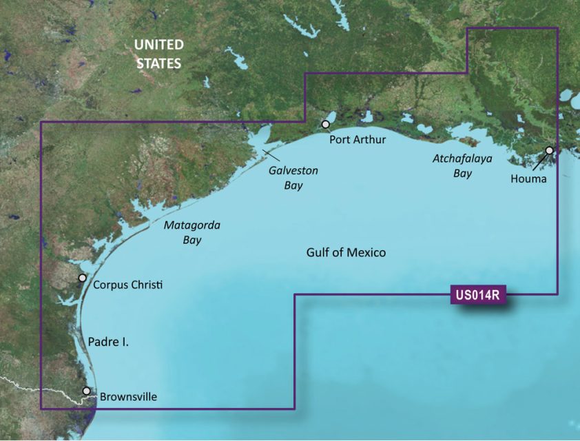
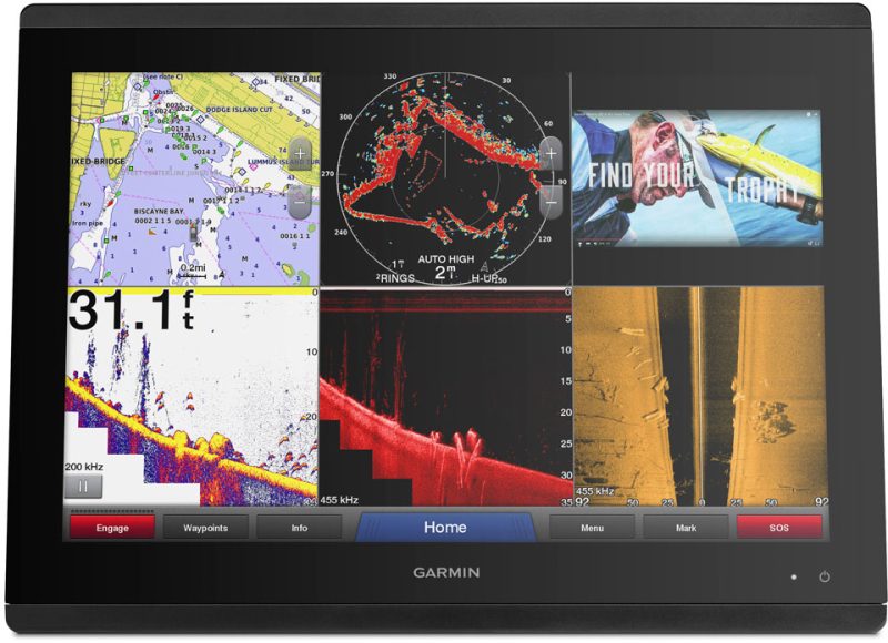
The Garmin VUS014R BlueChart g3 Vision HD – Morgan City to Brownsville offers updated coastal navigation charts with advanced features for recreational boaters and fishermen. It includes Auto Guidance technology, high-resolution relief shading, and integrated Garmin and Navionics data.
Features of the Garmin VUS014R BlueChart g3 Vision HD:
- Auto Guidance technology that calculates suggested routes based on your desired water depth and overhead clearance.
- High-resolution relief shading for enhanced underwater topographic imagery, aiding in navigation and identifying bottom structures.
- Up to 1′ contours for improved fishing charts and accurate navigation in swamps, canals, and marinas.
- Access to NOAA Raster Cartography2 featuring detailed views of ports, marinas, bridges, and nautical markers – downloadable via the ActiveCaptain app.
- MarineEye and FishEye views, offering 3-D perspectives above and below the waterline for advanced visual information.
- Integration of both Garmin and Navionics data for comprehensive charting information and enhanced detail.
Considerations and Safety:
- The Auto Guidance is a supplementary feature and should be used in conjunction with safe navigation practices.
- The chart has comprehensive coverage but remember to double-check for local updates and notices.
- Raster Cartography is not available on echoMAP CHIRP and ECHOMAP Plus combos, but accessible through the ActiveCaptain mobile app.
- Be aware of included chemicals known to cause health concerns and follow all provided safety instructions.
Continue with the FAQs section:
Frequently Asked Questions:
1. How does the Auto Guidance technology work?
The Auto Guidance technology calculates routes and suggests pathways based on your desired water depth and overhead clearance, helping you plan your journey effectively by considering potential obstacles and hazards.
2. How does the high-resolution relief shading enhance the readability of the chart?
The high-resolution relief shading blends color and shadow to provide a clearer image of the underwater topography, making it easier to identify bottom structures and navigate unfamiliar areas.
3. What level of detail does the BlueChart g3 Vision HD – VUS014R offer?
The BlueChart g3 Vision HD – VUS014R offers industry-leading coverage, clarity, and detail. It includes up to 1′ contours for enhanced fishing charts and navigation in swamps, canals, and marinas.
4. Can I access the NOAA Raster Cartography2 feature?
Yes, the chart provides access to the NOAA Raster Cartography2 feature, which gives comprehensive views of ports, marinas, bridges, and nautical markers. This feature can be downloaded for free via the ActiveCaptain app.
5. What are the MarineEye and FishEye views?
The MarineEye and FishEye views are 3-D perspectives that provide additional visual information both above and below the waterline. These views can be valuable for boaters and fishermen.
6. Is the Auto Guidance feature a replacement for safe navigation operations?
No, the Auto Guidance feature is a planning tool and should not be used as a replacement for safe navigation operations. It is important to rely on proper navigation practices and follow all relevant safety guidelines.
7. Is the raster cartography feature available on all devices?
The raster cartography feature is not available on echoMAP CHIRP and ECHOMAP Plus combinations. However, it can be accessed on mobile devices through the ActiveCaptain mobile app.
8. Are there any precautions I should take regarding the product?
Yes, it is important to be aware that this product contains chemicals that have been linked to cancer, birth defects, and reproductive damage. Consumers should take necessary precautions and follow all safety instructions provided.



Gareth –
Janine –
Kennedy –