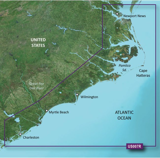
The Garmin VUS007R BlueChart g3 Vision HD – Norfolk to Charleston is a coastal navigation chart that comes equipped with updated features that make navigation easier and more efficient. With integrated Garmin and Navionics data, Auto Guidance technology, and up to 1′ contours for enhanced fishing charts and navigation in swamps, canals, and marinas, these charts offer industry-leading coverage, clarity, and detail.
The Auto Guidance technology is an excellent tool that calculates routes and suggests pathways based on your desired depth and overhead clearance. However, it's crucial to note that it's just for planning and does not substitute safe navigation operations. Additionally, high-resolution satellite photography provides comprehensive views of ports, marinas, bridges, and navigational markers that aid in enhancing situational awareness.
What's more, the chart also features unique 3-D views known as Marine Eye and Fish Eye views that provide extra viewpoints both above and below the sea line. Unfortunately, raster cartography is not available on the echoMAP CHIRP and ECHOMAP Plus combinations. Nonetheless, you can access it on mobile devices through the ActiveCaptain mobile app. Overall, the Garmin VUS007R BlueChart g3 Vision HD – Norfolk to Charleston is an excellent choice for anyone looking for a coastal navigation chart with high-quality features and functionality.
FAQs
1. Can I use the Auto Guidance technology for navigation?
Yes, you can use the Auto Guidance technology to calculate routes and suggest pathways for navigation based on your desired depth and overhead clearance. However, it's important to remember that Auto Guidance is only for planning purposes and should not replace safe navigation practices.
2. Does the chart provide high-resolution satellite photography?
Yes, the Garmin VUS007R BlueChart g3 Vision HD – Norfolk to Charleston chart features high-resolution satellite photography that provides comprehensive views of ports, marinas, bridges, and navigational markers, enhancing situational awareness.
3. Are there any unique viewing options available on the chart?
Yes, the chart offers unique 3-D views called Marine Eye and Fish Eye views that provide additional perspectives above and below the sea line, allowing for a more comprehensive understanding of the surroundings.
4. Can I access raster cartography on the echoMAP CHIRP and ECHOMAP Plus combinations?
No, unfortunately, raster cartography is not available on the echoMAP CHIRP and ECHOMAP Plus combinations. However, you can still access it on mobile devices through the ActiveCaptain mobile app.
5. Is the Garmin VUS007R BlueChart g3 Vision HD – Norfolk to Charleston suitable for coastal navigation?
Yes, the Garmin VUS007R BlueChart g3 Vision HD – Norfolk to Charleston is an excellent choice for anyone looking for a coastal navigation chart with high-quality features and functionality, including integrated Garmin and Navionics data, up to 1′ contours, and enhanced fishing charts.




Job –
Sari –
Cassie –
Hali –