Embark on a journey with precision using the Garmin Standard Mapping – Louisiana Central – Professional microSD/SD Card, a must-have navigational tool designed for boaters, fishermen, and outdoor enthusiasts who demand real-world accuracy. This product offers unparalleled mapping coverage of the central Louisiana region, ensuring every adventure is navigated with confidence.
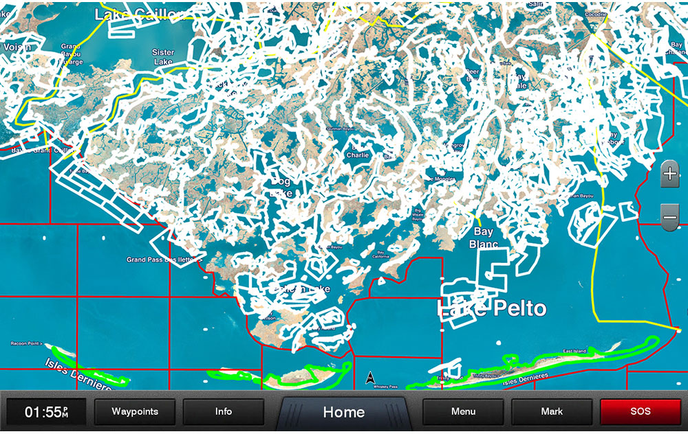
Unlock the full potential of your Garmin device with the integration of a statewide coastal aerial overlay, enhancing your situational awareness with high-resolution imagery and the localized naming of waterways and terrestrial elements. The overlay is especially useful for anglers and boaters who rely on clear visual references for safe and efficient travel.
Detailing critical regions such as Wildlife Management Areas and Offshore Lease Areas, this mapping tool provides invaluable insights for environmental conservationists and commercial entities to operate within legal and sustainable parameters.
An exceptional feature of this microSD/SD Card is the visualization of Oyster Leases, prominently demarcated in white for instant recognition—a vital asset for those in the aquaculture industry as well as recreational gatherers. Similarly, spots where man has intervened to help nature thrive, namely the Artificial Reef locations, are symbolized by a white dot to facilitate discovery for divers and marine biologists alike.
The State and Federal Offshore Boundaries are crisply delineated, offering peace of mind to navigators and fishermen who want to ensure compliance with regional jurisdictional laws. This feature proves indispensable for avoiding fines and legal complications while traversing the varied spatial governance areas.
Altogether, the Garmin Standard Mapping – Louisiana Central – Professional Edition is a meticulous and user-friendly mapping companion that enhances your experience when exploring the diverse and vibrant Central Louisiana landscape.
Maximize Your Louisiana Adventures: FAQs about the Garmin Louisiana Central Professional Mapping
1. What geographic span does the Garmin Professional Louisiana Central Mapping cover?
From the bustling cityscapes to secluded bayous, the card encompasses an extensive area of Central Louisiana, giving boaters and outdoor fans precise and expansive geographical data.
2. How does the coastal aerial overlay enhance the Garmin mapping experience?
With superior high-resolution imagery and specific nomenclature for coastal features, the overlay facilitates easy navigation and enriches the visual fidelity of your marine excursions.
3. Does the card detail ecological and commercial zones such as Wildlife Management Areas and Offshore Lease Areas?
Indeed, it does. The inclusion of such information is critical, aiding in the conservation of wildlife and ensuring responsible commercial activities.
4. How easily can users identify Oyster Lease Boundaries on the card?
A clear, white demarcation makes identification a breeze, thus optimizing routes for those who seek to harvest or regulate these precious marine resources.
5. Are Artificial Reef locations distinctive and simple to locate with this mapping solution?
Yes, these eco-friendly initiatives are clearly marked with a white dot, enabling adventurers to plan trips around these underwater havens.
6. Is the delineation of State and Federal Offshore Boundaries included?
Affirmative. The mapping software thoughtfully integrates these boundaries to keep users informed of their location in relation to different jurisdictional waters.








Shaketa –
Tambra –
Trevin –
Jennafer –
Chandler –