C-MAP 4D Electronic Marine Charts are a new kind of navigation solution that is designed to meet your boating needs. What sets C-MAP 4D apart is its ability to adapt and grow with you. This digital chart not only offers advanced features, but also allows you to add data and services as they become available.
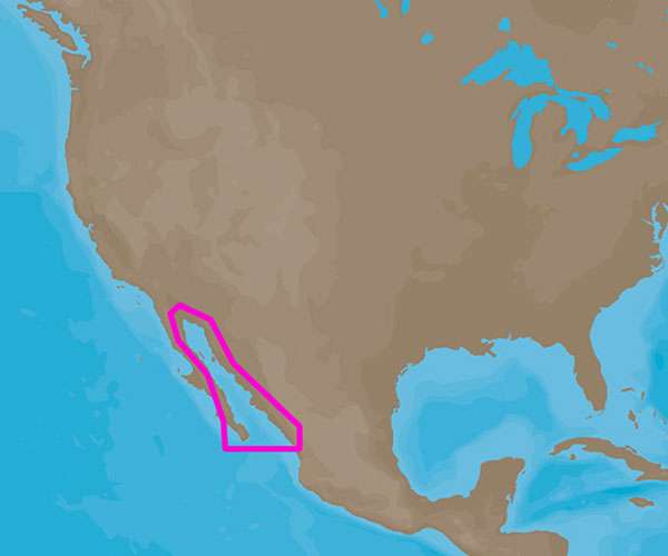
C-MAP 4D charts are compatible with the Furuno 1670F / 1870F, and Standard CPN 7000i, and CPN1010i units. This particular chart, NA-D950, covers the Gulf of California and Mexico.
If you're looking for more features and specifications, you'll find them here.
Frequently Asked Questions
1. Can I use this chart on other gps units?
No, this chart is specifically designed to be compatible with the Furuno 1670F / 1870F, and Standard CPN 7000i, and CPN1010i units.
2. Can I update the chart with new data in the future?
Yes, C-MAP 4D charts allow you to add data and services as they become available. This ensures that your navigation solution is always up-to-date.
3. Does this chart cover the entire Gulf of California?
Yes, NA-D950 covers the Gulf of California as well as Mexico. It provides comprehensive coverage for your boating needs in these areas.




Evelia –
Rustin –
Sherman –