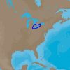
The C-MAP 4D NA-D933 is the ultimate navigation chart designed for mariners who navigate the waters of Lake Erie and Lake St Clair. It combines impeccable detail, a wealth of information, and a user-friendly interface, elevating the marine charting experience to new heights.
This series of electronic marine charts stands out because it is highly adaptive, offering features tailored to various boating activities, whether it's fishing, sailing, or cruising. Users can benefit from detailed chart layers, including high-resolution bathymetric data, which are crucial for those looking to find the best fishing spots or wanting to navigate safely in shallow waters.
The C-MAP 4D cartography is compatible with a range of devices, making it a versatile choice for many boaters. Specifically designed to work seamlessly with Furuno 1670F / 1870F, and Standard Horizon CPN 7000i, and CPN1010i units, it ensures that users can upgrade their existing systems without any hassle.
Here is a list of features you can expect from the C-MAP 4D Lake Erie and Lake St Clair – NA-D933:
- Dynamic Raster: Traditional paper chart look with the ability to access important information.
- 3D View: A bird's-eye view of your surroundings for better understanding of the environment.
- Satellite Images: High-resolution coastal imagery gives real-world references improving situational awareness.
- High-Resolution Bathymetry: Helps in identifying shallow areas, drop-offs, and ledges- perfect for fishing.
- Dynamic Tides and Currents: Predict the time, level, direction, and strength of tides and currents.
- Marina Port Plans: docking in an unfamiliar port is made easier with detailed marina port plans.
- Easy Routing: Automatically plots the shortest and safest route based on the boat's profile.
- Guardian Alarm: An extra layer of safety, it automatically searches C-MAP cartography for rocks, shallow areas, or other obstructions in your path.
- Multi-Language: Offers a wide range of language options to choose from, appealing to a global audience.
- Regular Chart Updates: Charts are frequently updated, so you always have the latest data.
With this wealth of features, C-MAP 4D charts are not just navigation tools but a complete maritime navigation solution that adapts and expands as new data and services arise.
FAQs
What devices are compatible with C-MAP 4D Lake Erie and Lake St Clair – NA-D933?
It can be used with devices such as Furuno 1670F / 1870F, and Standard Horizon CPN 7000i, and CPN1010i units.
What locations does the NA-D933 chart coverage include?
It encompasses detailed navigation information for Lake Erie and Lake St Clair.
What features can I expect from C-MAP 4D?
Users can look forward to advanced navigation features, detailed chart data, and the capacity to incorporate additional data and services.
Can I add data and services to C-MAP 4D charts?
Yes, the charts are designed to be adaptable, allowing for constant updates and enhancements.
The C-MAP 4D NA-D933 chart brings an unparalleled level of confidence to boaters navigating these Great Lakes, providing safety, efficiency, and enjoyment on the water.





Shakera –
Autumn –
Edlin –
Cason –