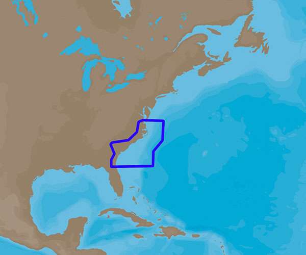
C-MAP 4D Electronic Marine Charts are an advanced navigation solution for boaters. Unlike other digital charts, C-MAP 4D offers a range of features and allows you to add data and services as they become available, making your time on the water safer and more enjoyable. The product provides detailed coverage for the coastal region from Norfolk, Virginia to Jacksonville, Florida, and is designed for use with specific chartplotter and multifunction display units.
C-MAP 4D is compatible with Furuno 1670F/1870F and Standard CPN 7000i/CPN1010i units, among others. This compatibility ensures that various boaters can utilize the technology seamlessly on their existing devices. With C-MAP 4D, you can expect more features and specifications to enhance your boating experience.
Key Features of C-MAP 4D
- High-resolution satellite imagery – Provides a clear view of the surroundings to enhance your situational awareness.
- 3D views – Offers a three-dimensional perspective of both land elevation and underwater terrain to aid in navigation.
- Dynamic tides and currents – Displays real-time tide and current information to plan your trips better.
- Easy Routing – Automatically plots the shortest and safest route based on the boat's draft, height, and width.
- Detailed marina charts – Helps you navigate in and out of marinas with confidence.
- Harbor and approach details – Enhances your approach strategies to unfamiliar destinations.
- Updateable – C-MAP 4D charts can be updated, keeping all your chart details as current as possible.
Frequently Asked Questions
Q: What devices are compatible with C-MAP 4D Norfolk to Jacksonville – NA-D942?
A: C-MAP 4D Norfolk to Jacksonville – NA-D942 is compatible with Furuno 1670F/1870F and Standard CPN 7000i/CPN1010i units.
Q: Does C-MAP 4D provide coverage from Norfolk to Jacksonville?
A: Yes, C-MAP 4D provides coverage from Norfolk to Jacksonville.
Q: Can I add additional data and services to C-MAP 4D as they become available?
A: Yes, C-MAP 4D allows you to add data and services as they become available, providing you with a comprehensive and up-to-date navigation solution.
Boaters who navigate the Atlantic coastline between Norfolk and Jacksonville can rely on C-MAP 4D for its accuracy, detailed information, and user-friendly features. Whether you're planning a short trip or a long journey, C-MAP 4D's navigational aids can help ensure a safer voyage.






Josh –
Jansen –
Denice –
Linnea –