Frequently Asked Questions
Q: What is the coverage area of the Middle Grounds section?
A: The Middle Grounds section covers an area of 656 square miles.
Q: What are the depths in the Middle Grounds section?
A: The depths in the Middle Grounds section range from 75′ to 225′.
Q: What is the coverage area of the Steam Boat Lumps section?
A: The Steam Boat Lumps section spans 150 square miles.
Q: What are the depths in the Steam Boat Lumps section?
A: The depths in the Steam Boat Lumps section range from 220′ to 500′.
Q: What is the coverage area of the Elbow section?
A: The Elbow section encompasses an area of 40 square miles.
Q: What are the depths in the Elbow section?
A: The depths in the Elbow section range from 144′ to 215′.
Q: Where are the northern and southeastern ends of the reef system located?
A: The northern end of the reef system is located approximately 65 nautical miles south of Apalachicola, while its southeastern end is about 70 nautical miles west-northwest of Tampa.
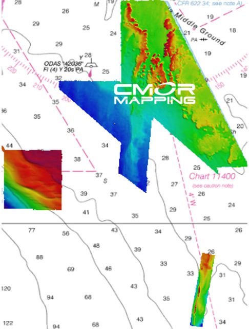
Q: What does the CMOR Mapping include?
A: CMOR Mapping provides bathymetry data, offering comprehensive and accurate information on the Middle Grounds area.
Q: What is the compatibility of CMOR Cards?
A: CMOR Cards are specifically designed for Raymarine devices and are compatible with units capable of running the Lighthouse II and Lighthouse 3 interfaces.
Q: What software version is required for CMOR Mapping?
A: It is essential to have at least v17 software installed on the units in order to support CMOR Mapping.
Q: Which Raymarine devices are compatible with CMOR Cards?
A: Compatible devices include the Axiom Series, Axiom Pro, Hybrid Touch, aSeries, cSeries, eSeries, eS Series, gS Series, and Dragonfly Series.



Shanda –
Kathyrn –
Fatima –
Raymundo –