The **Garmin 010-C0732-20 Bluechart G2 Southwest Caribbean microSD/SD Card** is an essential navigation aid designed for mariners and fishers venturing into the waters of the Southwest Caribbean. This product offers an extensive range of features that enhance maritime activities such as fishing, sailing, and cruising, by providing detailed and accurate maritime cartography.
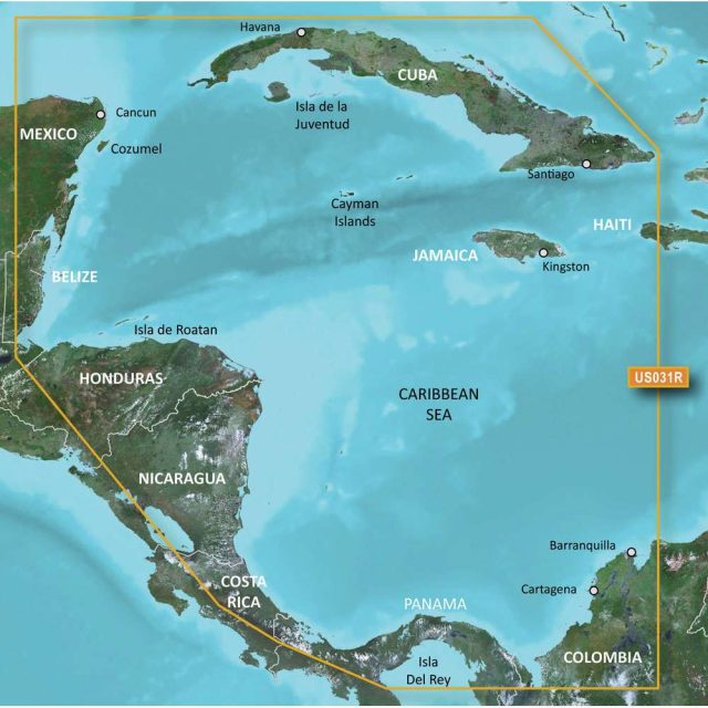
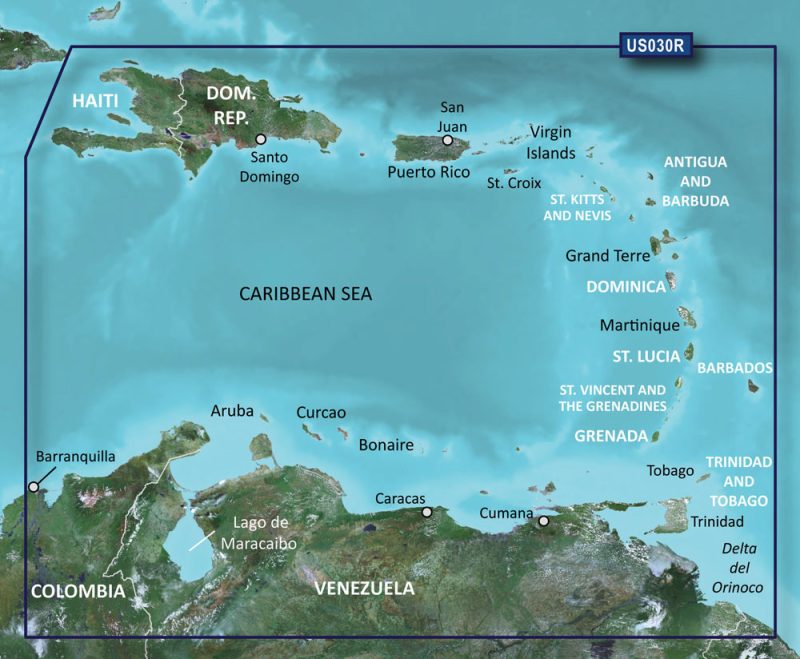
Featuring coverage that includes the entire northern coast of Central America, mariners can confidently navigate complex waters with ease. From the historically significant Panama Canal to the idyllic beaches of Jamaica, Cuba, and the Caymans, Garmin's advanced charting technology helps ensure a safer and more enjoyable voyage.
Key features of the Garmin Bluechart G2 Southwest Caribbean microSD/SD Card include:
- Detailed 1-foot HD fishing contours for prompt identification of prime fishing locations
- Vector object-oriented data that offers precision navigation
- Clear and seamless chart presentation to quickly assimilate navigational details
- Shaded depth contours providing a clear depiction of underwater structures
- Spot soundings of intertidal zones, enhancing safety during navigation
- Comprehensive port plans and tide station intel for selected countries
- Information on hazards such as wrecks, restricted areas, and marine sanctuaries
- Locations for anchorage points, marina points of interest, aids to navigation, slipways, and more
- Extensive bathymetric fishing charts aiding in the understanding of local fish habitats
- Tide current graphs for strategic fishing and boating planning
The Garmin Bluechart G2 card is built with data sourced from authoritative government and private entities, melding various charts and references into a cohesive and user-friendly cartographic product. This combination makes for an enhanced experience where the accuracy of navigational data is crucial for safety at sea.
Note that this microSD/SD card product is tailored for compatibility with Garmin devices, particularly Garmin handhelds and chartplotters. Its geographic coverage is specific to the Southwest Caribbean, and while global coverage is accessible, it is sectioned regionally to cater to localized demands.
In conclusion, the **Garmin 010-C0732-20 Bluechart G2 Southwest Caribbean microSD/SD Card** stands as a top-tier resource for anyone needing thorough and dependable maritime charts in the Southwest Caribbean. With its multitude of features and robust data compilation, it acts as a trusted guide through the beautiful but intricate waters of this region.
Frequently Asked Questions
Q: Can this microSD/SD card be used with any Garmin device?
A: No, this card is specifically designed for use with Garmin handhelds and chartplotters.
Q: Does this card provide information about tide stations?
A: Yes, the card includes tide stations for selected countries in the covered region.
Q: Are the fishing charts included in this card?
A: Yes, the card provides full bathymetric fishing charts for a more comprehensive fishing experience.
Q: Is the navigational information reliable and accurate?
A: Yes, the card is compiled using data from both government and private sources to ensure accurate and reliable navigation.
Q: Does this card cover the entire Caribbean region?
A: No, this card specifically covers the southwest Caribbean, including the northern coast of Central America.






Keyana –
Mathew –
Riki –
Anamarie –
Andy –
Paolo –