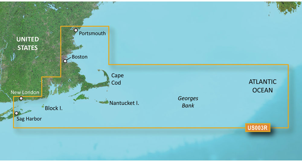
The Garmin VUS003R BlueChart g3 Vision HD – Cape Cod offers cutting-edge maritime navigation technology that combines the best of both Garmin and Navionics content. This powerful chartplotter offers unrivaled coverage, clarity, and detail along with the integration of high-quality charting data for avid mariners and recreational boaters navigating the waters of Cape Cod. The update brings together crucial navigational information and advanced features like detailed bathymetry, which are essential for navigating coastal waters with precision and safety.
One of the standout features included in this product is the innovative Auto Guidance technology. This intuitive tool goes beyond traditional chart plotting by automatically calculating a route that is not only optimized but also takes into account your vessel's specific size and your predefined safety parameters, such as desired depth and overhead clearance. This creates a custom, navigable path to safely guide you to your destination, a revolutionary supplement to manual navigation planning.
Moreover, the charts come equipped with high-resolution relief shading. This impressive detail provides mariners with enhanced bottom structure visualization, which can be pivotal when navigating through intricate seabeds or fishing grounds. The relief shading ensures that the underwater terrain is represented with gradient colors and dynamic shadows, offering a more realistic view that goes beyond the traditional flat contour lines.
For those who utilize Garmin's ActiveCaptain community-based platform, there is an added benefit. You are granted free access to NOAA Raster Cartography2. This feature provides an additional layer of information with up to ten varying depth ranges, shallow water shading, and detailed satellite imagery. Having high-resolution images of ports, marinas, and notable navigational marks greatly enhances situational awareness and safe navigation.
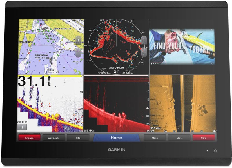
Among the exciting functionalities are the MarineEye and FishEye 3-D views. These provide exceptional perspectives both above and below the waterline, allowing you to better understand the maritime environment around your vessel. These 3-D features can be indispensable for specialized tasks such as locating fishing spots or comprehending complex maritime landscapes for safe anchorage.
As an important reminder, while Auto Guidance is sophisticated, it is crucial to understand that it serves as an aid and not a replacement for traditional safe navigation practices. Mariners should always maintain best navigational practices, even when using advanced technological tools.
It's also worth noting that not all Garmin devices support the Raster Cartography; specifically, the echoMAP CHIRP and ECHOMAP Plus devices are exempt. Nevertheless, for users with compatible devices, the integration of these charts through the ActiveCaptain mobile app can still be achieved, providing flexible access to these detailed maps on portable devices.
FAQs: Your Guide to Advanced Marine Navigation with Garmin VUS003R
Q: What features does the Auto Guidance tool provide?
A: The Auto Guidance tool generates personalized sailing paths factoring in critical parameters like desired depth and overhead clearances, substantially enhancing your navigational plans.
Q: Why is high-resolution relief shading significant?
A: High-resolution relief shading provides a superior understanding of underwater terrains by utilizing graduated colors and shadow effects, which is crucial for safe marine navigation and locating fishing areas.
Q: Is NOAA Raster Cartography2 accessible to all users?
A: ActiveCaptain users can download NOAA Raster Cartography2 without additional charges, gaining access to comprehensive depth ranges and exceptional satellite imagery to boost their navigational awareness.
Q: What benefits do MarineEye and FishEye views offer?
A: MarineEye and FishEye views are innovative 3-D representations that offer unparalleled perspectives above and below the waterline, which can be crucial for informed navigation and fish finding.
Q: Can the Auto Guidance feature be solely relied upon for navigation?
A: No, the Auto Guidance feature is a supplementary tool intended to aid in planning your route. Mariners are advised to continue practicing safe navigation techniques.
Q: Are all Garmin chartplotters compatible with Raster Cartography?
A: Compatibility with Raster Cartography is not universal across all Garmin chartplotters. Devices like the echoMAP CHIRP and ECHOMAP Plus do not support this feature; however, it is accessible via mobile devices through the ActiveCaptain app.
By providing these insights and expanding upon the features of the Garmin VUS003R BlueChart g3 Vision HD – Cape Cod maritime charts, this content aims to assist mariners in better understanding the product's value and how it can significantly enhance their navigational experience.




Trinidad –
Roger –