

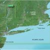
The Garmin VUS004R BlueChart g3 Vision HD – New York is an advanced coastal navigation chart that offers unparalleled charting for boaters and fishermen looking to navigate the waters of New York with confidence and ease. This product provides industry-leading coverage, clarity, and detail through the integration of Garmin and Navionics data.
One of the standout features of this chart is the Auto Guidance technology, which intelligently calculates and recommends routes based on the vessel's specifications considering depth and overhead clearance. This is a significant aid in marine planning and can help mariners to identify the safest passages while avoiding potential hazards.
The Garmin BlueChart g3 Vision also offers high-resolution relief shading, which adds depth to the chart by combining color gradients and casting shadow effects for a more realistic depiction of the ocean's floor. This high level of detail is invaluable when navigating tricky areas with varying bottom structures.
Furthermore, the product includes a range of features to enhance your situational awareness and aid in safe navigation:
- Depth range shading to display varying depth intervals
- Shallow water shading for a clear view of shallow waters to avoid while navigating
- High-resolution satellite imagery to provide a bird's-eye view of ports, marinas, waterways, and coastal features
Please note that the Garmin VUS004R is intended for planning purposes and should not replace safe navigation practices. The raster cartography is accessible as a downloadable feature through the ActiveCaptain software, providing unique 3-D views such as Marine Eye and Fish Eye for above and below the waterline perspectives. Additionally, while Auto Guidance is a helpful tool for planning, it should not be solely relied upon for navigation decisions.
The compatibility with ActiveCaptain mobile app allows users to access these navigational charts on-the-go from their mobile devices, offering greater flexibility and convenience.
Frequently Asked Questions
Can this chart be used for actual navigation?
No, the Garmin VUS004R BlueChart is intended for planning purposes and should not be used as a standalone tool for navigation, but rather in conjunction with other safe navigation practices.
What does Auto Guidance technology do?
Auto Guidance technology uses the vessel's specific characteristics to calculate and recommend optimal routes based on depth and overhead clearance, contributing to a safer and more efficient voyage planning.
What is included in the high-resolution relief shading feature?
The high-resolution relief shading ensures that mariners get a clear and detailed view of the sea bed structure, which can be critical in coastal navigation.
Are there any additional features available?
Yes, along with deep and shallow water shading and high-resolution satellite imagery, the product offers various navigational aids to improve the user's awareness of the marine environment.
Can I view this product on my mobile device?
Yes, the Garmin VUS004R BlueChart g3 Vision HD can be viewed on mobile devices using the ActiveCaptain mobile app, integrating seamlessly with your digital boating lifestyle.


Saleem –
Roosevelt –
Bijan –
Stan –
Reed –
Misty –