

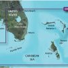
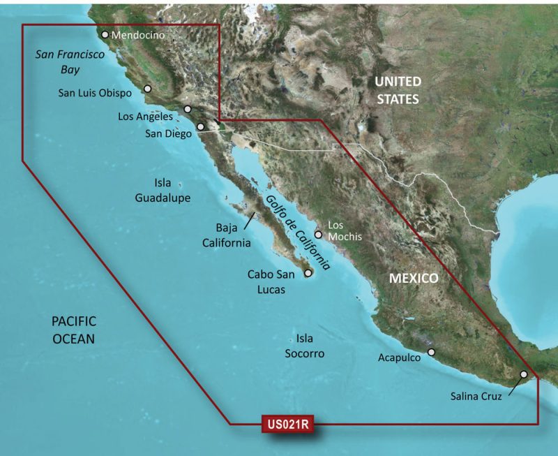
Navigators and fishing enthusiasts seeking premium marine cartography for the coastal regions of Southeast Florida will find the Garmin VUS010R BlueChart g3 Vision HD to be an indispensable tool. This maritime navigation chart provides expansive coverage and high-detail mapping, ensuring a safer and more informed journey across Southeast Florida's varied marine landscapes.
The BlueChart g3 Vision HD series is renowned for its incorporation of both Garmin and Navionics content, resulting in the most accurate and comprehensive coastal chart updates. The VUS010R model in particular covers critical areas like the Bahamas, Vero Beach, Lake Okeechobee, the Florida Keys, the Dry Tortugas, and extends northwards to Naples on the west coast of Florida. The intricate detail of the included Explorer Charts is invaluable for plotting courses through these locales, particularly when sailing or cruising around notable island areas such as Andros, Eleuthera, Cat, Great Exuma, Little Exuma, and Hog Cay.
Equipped with pioneering Auto Guidance technology, the Garmin VUS010R chart calculates efficient routes and offers navigation suggestions that can be tailored to the size and draft of your vessel, thereby optimizing your passage. This makes for a seamless sailing experience whether you're headed on a long-distance cruise or a local fishing trip.
Additionally, the groundbreaking integration of high-resolution relief shading on the VUS010R enhances the visual depiction of depth contours and underwater structures. This feature proves essential for anglers and divers by providing them with accurate fishing charts and a clearer understanding of the seabed, hence optimizing their sport and exploration activities.
Beyond precision mapping, the BlueChart g3 Vision HD – VUS010R offers an extensive display of NOAA Raster Cartography, enriching your navigational toolkit with detailed images of ports, marinas, bridges, and pertinent nautical reference points. This aids in familiarizing users with new and unfamiliar docking locations or aiding seasoned navigators with easy planning and journey tracking. Free access to the NOAA raster charts is available through the convenient ActiveCaptain app—Garmin's all-in-one mobile application for networked marine electronics.
Despite the advanced 3-D viewing capabilities, like Marine Eye and Fish Eye perspectives, Garmin emphasizes that these features are designed to complement, rather than replace, traditional navigation practices. It is always advisable to engage multiple sources and methods of navigation to ensure the utmost safety while at sea.
For those using Garmin's echoMAP CHIRP and ECHOMAP Plus devices, it is important to note that certain features, including raster cartography, will not be applicable. Nevertheless, these users can still leverage the extensive capabilities of VUS010R through the ActiveCaptain app for mobile access to their crucial navigation data.
Garmin's commitment to customer safety and regulatory compliance is reflected in the product's safety warning label, which is an industry-standard notification about the presence of materials that could potentially pose health risks, as stipulated by state and federal laws.
Frequently Asked Questions (FAQs)
1. Which devices are compatible with the Garmin VUS010R BlueChart g3 Vision HD?
While the raster cartography feature is not included on the echoMAP CHIRP and ECHOMAP Plus series, the VUS010R chart is widely compatible with various other Garmin chartplotter devices, and its full features can be accessed on compatible devices or via the ActiveCaptain mobile app.
2. What advantages does the Auto Guidance feature offer?
The Auto Guidance feature simplifies your course planning by proposing the most efficient paths based on your vessel's specifications, environmental conditions, and chart data, making your voyages both time and fuel-efficient.
3. Is the Garmin VUS010R suitable for both professional and recreational use?
Yes, whether you're a professional mariner or a recreational boater, the Garmin VUS010R BlueChart g3 Vision HD provides detailed marine mapping that enhances situational awareness and safety for all users.
4. How often is the chart data updated?
Garmin regularly updates their BlueChart data to ensure the most current navigational information is available. Users can check for update frequency and access the latest updates through Garmin Express or the ActiveCaptain app.
5. Does this product offer any advanced views?
Yes, the BlueChart g3 Vision HD – VUS010R includes sophisticated 3-D views such as Marine Eye and Fish Eye perspectives, alongside high-resolution bathymetric contours, which are valuable for both navigational planning and fishing activities.


Alyce –
Douglas –
Santina –