

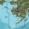
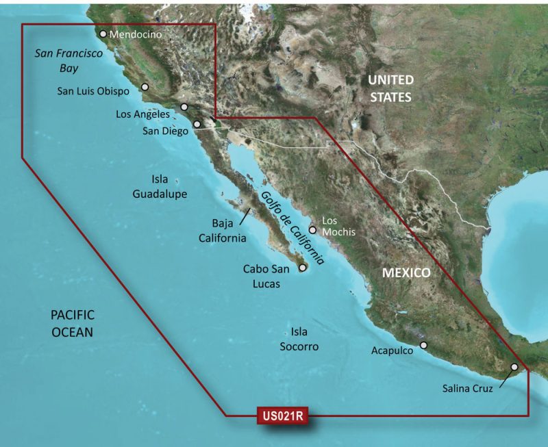
The BlueChart g3 Vision HD – VUS033R is an exceptional, coastal navigation chart known for its extensive coverage and superior quality. It covers the region from Sutwik Island to Kotzebue Sound, including Dillingham, Kvichak Bay, Port Moller, Chignik Bay, Norton Sound, and Bristol Bay, as well as Akutan and Unimak Pass and the Aleutian Islands stretching from Unalaska Island to Unimak Island.
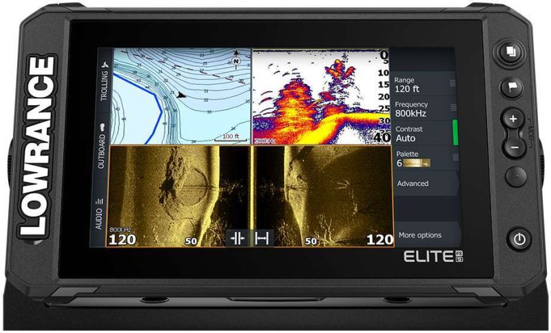
This coastal chart utilizes Garmin and Navionics data, offering unparalleled coverage, clarity, and detail with its revised coastal charts. The Auto Guidance technology calculates paths based on your depth and overhead clearance preferences and displays the proposed path to follow. The high-resolution relief shading displays the shadow and color blending for a clearer representation of bottom structures that surpasses contour lines.
NOAA Raster Cartography is also available on this graphic, allowing users to determine their desired depth quickly. It also features depth range shading to warn of shallow water depths. High-resolution satellite photography offers comprehensive photographs of ports, marinas, bridges, and navigational markers, providing superior situational awareness.
It is important to remember that the BlueChart g3 Vision HD is intended solely for planning purposes and should not replace safe navigation operations. It is also crucial to note that the echoMAP CHIRP and ECHOMAP Plus combinations do not support raster cartography, but it is viable on mobile devices through the “ActiveCaptain” mobile app.
Lastly, consumers should be aware that the product comes with a warning label as it could expose individuals to chemicals known to the state of California to cause cancer, birth defects, or reproductive damage. For additional information, visit P65Warnings.ca.gov.
Frequently Asked Questions about Garmin VUS033R BlueChart g3 Vision HD
1. Can I use the BlueChart g3 Vision HD for navigation?
While the BlueChart g3 Vision HD is a powerful tool for planning your navigation, it should not replace safe navigation operations. It is intended for planning purposes only.
2. Can I use the BlueChart g3 Vision HD with echoMAP CHIRP or ECHOMAP Plus combinations?
No, the echoMAP CHIRP and ECHOMAP Plus combinations do not support raster cartography. However, you can still access the BlueChart g3 Vision HD on mobile devices through the “ActiveCaptain” mobile app.
3. What is the advantage of NOAA Raster Cartography on this graphic?
NOAA Raster Cartography allows you to quickly determine your desired depth. It also features depth range shading to warn of shallow water depths.
4. Does the BlueChart g3 Vision HD provide high-resolution satellite photography?
Yes, the BlueChart g3 Vision HD offers high-resolution satellite photography, providing comprehensive photographs of ports, marinas, bridges, and navigational markers for superior situational awareness.
5. Is there anything I should be aware of before purchasing the BlueChart g3 Vision HD?
Yes, it is important to be aware that the product comes with a warning label as it could expose individuals to chemicals known to the state of California to cause cancer, birth defects, or reproductive damage. For additional information, visit P65Warnings.ca.gov.


Shameka –
Stan –
Marquise –
Antwuan –
Reva –