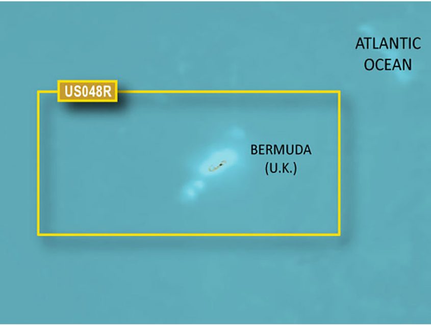
The BlueChart g3 Vision HD – VUS048R – Bermuda provides detailed coverage of Bermuda, including popular areas such as Saint George's Island and Harbour, Harrington Sound, Somerset Island, the Great and Little Sounds, Hamilton Island, and Castle Harbour. These Premier Coastal Navigation Charts offer unparalleled coverage, clarity, and detail with integrated Garmin and Navionics data.
With Auto Guidance technology, this chart calculates and suggests pathways, making navigation easier. The high-resolution relief shading adds depth and clarity to the bottom structure, while the depth range shading, shallow water shading, and high-resolution satellite imagery provide enhanced situational awareness.
It's important to note that this product is designed for planning purposes and should not be used as a substitute for safe navigation activities.
It's worth mentioning that while raster cartography is not available on the echoMAP CHIRP and ECHOMAP Plus combinations, it can be accessed on mobile devices using the ActiveCaptain mobile app. This software is recommended for those looking to enhance their fishing charts and navigation in swamps, canals, and marinas.
Frequently Asked Questions:
Q: Can I use this chart for real-time navigation?
A: No, this product is designed for planning purposes and should not be used as a substitute for safe navigation activities. It provides detailed coverage and can help you plan your routes, but real-time navigation should be done using appropriate navigational equipment.
Q: What areas of Bermuda does this chart cover?
A: The Bluechart g3 Vision HD – VUS048R – Bermuda provides detailed coverage of popular areas such as Saint George's Island and Harbour, Harrington Sound, Somerset Island, the Great and Little Sounds, Hamilton Island, and Castle Harbour.
Q: Does this chart offer Auto Guidance technology?
A: Yes, this chart features Auto Guidance technology, which calculates and suggests pathways, making navigation easier.
Q: What additional features does this chart offer?
A: In addition to Auto Guidance technology, this chart also provides high-resolution relief shading, depth range shading, shallow water shading, and high-resolution satellite imagery for enhanced situational awareness.
Q: Can I use raster cartography with the echoMAP CHIRP and ECHOMAP Plus combinations?
A: No, raster cartography is not available on the echoMAP CHIRP and ECHOMAP Plus combinations. However, you can access it on mobile devices using the ActiveCaptain mobile app, which is recommended for enhancing fishing charts and navigation in swamps, canals, and marinas.




Austen –
Marni –
Byron –
Genesis –
Rafeal –