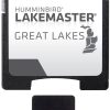
The Humminbird LakeMaster Great Lakes v4 microSD map card is an essential tool for anglers and boaters navigating the extensive waterways of the Great Lakes region. The card has been updated to provide even more detailed information on popular lakes and fishing spots.
Key Features of the Humminbird LakeMaster Chart:
- Extensive Coverage: Includes over 1540 lakes, with more than 380 lake maps in High Definition for Michigan, Indiana, and Ohio, delivering precise mapping for both shallow and deepwater anglers.
- 140 New Lakes Added: The latest version includes over 140 new lakes and 50 High Definition waters, expanding angling opportunities.
- Detailed Contours: Easy-to-read contours make locating fish-holding structures easier.
- High Definition Surveys: High Definition surveys include waters like Beaver Island on Lake Michigan, Detroit River, St. Clair River, and many more.
- Full Lake Huron Coverage: Features full mapping for Lake Huron, including Georgian Bay.
- Updated Shallow Water Areas: Offers updated mapping of shallow water areas for Lake Michigan and parts of Lake Superior to enhance safety.
- i-Pilot Link Compatibility: Allows for easy integration with your Humminbird fishing system for advanced navigation and fishing capabilities.
- Depth Highlight Range: Set a specific depth to highlight, helping to identify productive water depths for fishing.
- Water Level Offset: Adjust the map to the current water level for more accurate depth readings.
- Shallow Water Highlight: Emphasizes shallow water areas to prevent running aground.
- Scrollable Lake List: Quickly find your desired lake from a comprehensive, easy-to-navigate list.
Please note that the Great Lakes v4 map card does not include lakes in Kentucky and Tennessee; additional regional map cards like the LakeMaster Southeast Edition should be used for those states.
Frequently Asked Questions
What lakes are included in the Humminbird LakeMaster Great Lakes v4 map card?
The Humminbird LakeMaster Great Lakes v4 map card provides in-depth mapping for over 1540 lakes, with precision High Definition maps for more than 380 lakes in Michigan, Indiana, and Ohio, extensive coverage of Lake Huron, and updated shallow water mapping for areas including Lake Michigan and parts of Lake Superior.
What makes the LakeMaster Great Lakes v4 map card a must-have for anglers and boaters?
The LakeMaster Great Lakes v4 offers an array of features, like i-Pilot Link compatibility, detailed contours, depth highlight range, water level offset, and shallow water highlight, which are designed to improve the fishing and boating experience by providing valuable lake insights and advanced navigation options.
Why are Kentucky and Tennessee lakes not on the Great Lakes v4 map card?
The Great Lakes v4 map card is focused on the Great Lakes region. For Kentucky and Tennessee lake maps, anglers and boaters should look to the LakeMaster SouthEast Edition to find detailed information for lakes in those states.





Alonna –
Chari –