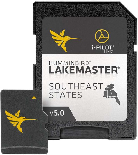
The latest iteration of the Humminbird LakeMaster Chart – Southeast States Version 5 presents an unprecedented level of precision and detail for avid anglers and outdoor enthusiasts. Tailored to enhance your fishing expeditions, the chart is designed with user-friendly features like easy-to-read contours, highlighted depth ranges, and an extensive, scrollable list of lakes. Its exclusive compatibility with Humminbird fish finders elevates the angler's experience with specialized regional and lake maps.
With a robust collection of over 10,000 lake maps within its digital library, this navigational aid spans multiple regions across North America, including expansive coverage in Canada. Approximately 2,000 of these aquatic terrains are meticulously surveyed and presented in High Definition quality, reflecting the unparalleled survey data curated by renowned Humminbird GIS analyst cartographers. The Standard Definition maps complement the HD selection, offering significant details with contour intervals typically set between 3′-5′.
At the heart of the Humminbird LakeMaster creation process lies a commitment to precision. Publicly sourced baseline information is refined and verified, ensuring the accuracy of features like shorelines and on-water structures. The symbiotic relationship between LakeMaster maps, market-leading Humminbird fish finders, and cutting-edge Minn Kota trolling motors coalesces into a seamless, technology-driven fishing adventure.
For the diligent angler seeking a competitive edge, the Humminbird LakeMaster PLUS series is the key. This elevated mapping solution incorporates all the foundational elements of the LakeMaster with the transformative addition of aerial photography for High Definition lakes. This enhancement illuminates critical elements, including contour alignments, docks, and constructed entities. These aerial perspectives can be layered directly onto your Humminbird fish finder, offering a single-layer view, a fusion with LakeMaster depth contours, or a full map overlay for comprehensive details.
Among the array of features, the LakeMaster Louisiana Delta Aerial View asserts itself as an invaluable asset. It demystifies the waterways and landscapes of the Louisiana Delta, providing a bird's-eye view of intricate shorelines, navigational markers, notable impediments, accessible roads, and additional points of interest.
Additional highlighted features encompassed within the Humminbird LakeMaster Chart enhance its utility:
- Highlight Depth – Easily customize and highlight specific depth ranges, ensuring the prime fishing zones stand out for efficient targeting.
- Shallow Water Highlight – An adjustable shading feature that illuminates shallow water up to the depth of 30 feet, promoting safer navigation.
- Water Level Offset – Allows for real-time adaptation of LakeMaster chart contours and shorelines to align with current water levels in lakes, reservoirs, and rivers.
- i-Pilot Link – Fosters a harmonious interaction between the LakeMaster lake maps, Humminbird fish finders, and Minn Kota trolling motors, leading to groundbreaking automatic boat control possibilities.
- Contour Elite – Fuses the detailed High Definition maps of LakeMaster with predictive algorithms from SmartStrike. This powerful tool aids anglers in pinpointing ideal fishing spots according to species, seasonal patterns, weather conditions, or specific water characteristics. It boasts sophisticated capabilities and a user-friendly interface on your PC, including 3D visualizations, precise waypoint management, and custom printed maps to enhance your preparatory research and on-water strategy.
Available across nine distinct editions to match LakeMaster SD card regions, the Humminbird LakeMaster Chart – Southeast States Version 5 is a quintessential resource for any serious angler looking to optimize their time on the water.
Frequently Asked Questions (FAQs)
Q: How extensive is the lake map coverage within the Humminbird LakeMaster Chart?
A: The collection boasts an impressive roster of over 10,000 lake maps, ensuring comprehensive coverage across various regions, embracing the breadth of North America, and extending into Canadian waters.
Q: What distinguishes High Definition lakes in the Humminbird LakeMaster Chart?
A: The High Definition lake maps stand out with their meticulous attention to detail and superior accuracy. Close to 2,000 lakes have been rendered in this format, courtesy of skilled GIS analyst cartographers at Humminbird.
Q: Can the Humminbird LakeMaster PLUS option elevate my fishing experience?
A: Absolutely. The PLUS series enhances the foundational LakeMaster features with vivid aerial photography for High Definition lakes, offering clarity on underwater and above-water features alike.
Q: Is it possible to integrate aerial imagery with my Humminbird fish finder?
A: Yes, aerial images can be interactively displayed on Humminbird fish finders, allowing you to layer these images with both LakeMaster depth contours and the comprehensive LakeMaster maps for unparalleled detail.
Q: What unique feature does the Humminbird LakeMaster Chart offer for the Louisiana Delta?
A: The Louisiana Delta benefits from the specialized LakeMaster Louisiana Delta Aerial View, which presents exhaustive aerial representations of the region's dynamic terrain, facilitating strategic navigation and exploration.

