C-MAP 4D Electronic Marine Charts are the modern solution for sophisticated marine navigation. Designed to cater to a range of boating requirements, these electronic marine charts are renowned for their rich features and the flexibility to incorporate additional data and services over time.
The C-MAP 4D cartography is built for compatibility with the Furuno 1670F / 1870F, and Standard CPN 7000i, and CPN1010i units. This ensures that owners of these popular navigation units can integrate the power of C-MAP 4D charts into their voyages.
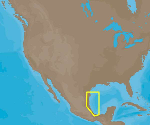
For nautical adventurists planning to navigate the waters from Brownsville, Texas, to Coatzacoalcos, Mexico, the C-MAP 4D NA-D946 offers expansive coverage. This digital chart provides detailed mapping and critical navigational information for the specified maritime region.
The C-MAP 4D technology is designed to augment your time on the water, giving you peace of mind and enhancing your nautical journeys. By choosing the C-MAP 4D Brownsville, TX to Coatzacoalcos, MX – NA-D946, mariners can expect a host of features and specifications that will elevate their experience at sea.
- High-resolution satellite imagery for real-world navigation scenarios
- Dynamic tides and currents predictions to plan safer passages
- Detailed harbor charts for entering and exiting ports with ease
- 3D views and overlays for better situational awareness
- Easy routing with autorouting features to navigate complex waters confidently
Frequently Asked Questions:
Q: Can I use the C-MAP 4D Electronic Marine Charts with my Furuno 1670F unit?
A: Absolutely. The C-MAP 4D cartography is fully compatible with the Furuno 1670F. You will be able to use the rich feature set of the C-MAP 4D charts on this device.
Q: Is the C-MAP 4D NA-D946 compatible with the Standard CPN 7000i unit?
A: Yes, it is. The chart is compatible with the Standard CPN 7000i unit, ensuring that you gain access to all its detailed features and capabilities.
Q: What is the coverage area of the C-MAP 4D NA-D946?
A: The NA-D946 chart covers the vast marine area extending from Brownsville, TX, down to Coatzacoalcos, MX, providing comprehensive mapping information and navigational assistance.
Q: What features and specifications can I expect from C-MAP 4D?
A: With C-MAP 4D, you gain access to a multitude of advanced navigation features. These include photo-realistic views, dynamic tides and currents, and customizable data layers. Essentially, it's an investment in expansive, reliable, and up-to-date nautical information.





Bonnie –
Whittney –
Rania –
Tran –
Cayce –