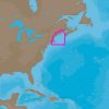
For boating enthusiasts and professional mariners, C-MAP 4D Electronic Marine Charts represent a comprehensive and dynamic navigational tool. They are part of an evolutionary series of charting solutions designed to cater to your navigational prerequisites with the capability to integrate new data and services as they are developed. Crafted to furnish unparalleled charting intelligence, these digital marine charts ensure that your time on the waters, from Passamaquoddy Bay to Block Island, is both safe and enjoyable.
When it comes to compatibility, C-MAP 4D cartography is specifically engineered to work seamlessly with a selection of chartplotters, including the Furuno 1670F / 1870F, as well as the Standard CPN 7000i and CPN1010i units. If you're the owner of any of these models, updating your system with the C-MAP 4D NA-D939 chart can expand your navigational capabilities exponentially.
To delve into the manifold features and further explore what specifications this chart offers, we invite you to uncover more:
Frequently Asked Questions
1. Is this chart compatible with other marine chartplotter brands?
While the C-MAP 4D NA-D939 chart is a perfect match for select Furuno and Standard models, compatibility with other chartplotter brands isn't guaranteed. Prior to purchasing, it's crucial for navigators to verify compatibility with their specific equipment to optimize their marine navigation system.
2. Can I add additional data and services to the C-MAP 4D chart?
Indeed, one of the remarkable benefits of the C-MAP 4D chart lies in its ability to be updated with additional data and services over time. This unique feature ensures your charting solutions can develop in concert with new technologies and information, maintaining your navigational experience at the cutting edge.
3. What is the coverage area of the C-MAP 4D NA-D939 chart?
Boaters journeying from the cool waters of Passamaquoddy Bay to the scenic surroundings of Block Island will find the C-MAP 4D NA-D939 chart to be an essential companion. This coverage ensures detailed mapping of ports, marinas, and important navigational features across this significant expanse of Eastern seaboard.
4. Can I use this chart for navigation in offshore waters?
Mariners traversing offshore passages within the chart's delineated region will benefit immensely from the precise and extensive information provided by the C-MAP 4D NA-D939. It's designed to facilitate a vigilant and informed approach to offshore navigation, bolstering confidence in the decisions you make while at sea.
For boaters looking for a reliable electronic charting system to guide their coastal and offshore adventures, the C-MAP 4D NA-D939 is a navigational cornerstone that ensures a safer, more enjoyable experience with upgraded precision and functionality. As you venture through the striking waters from Passamaquoddy Bay to Block Island, trust in this robust marine chart for unmatched guidance.








Brandilyn –
Gina –
Jc –
Kandis –
Sarahann –
Nakesha –