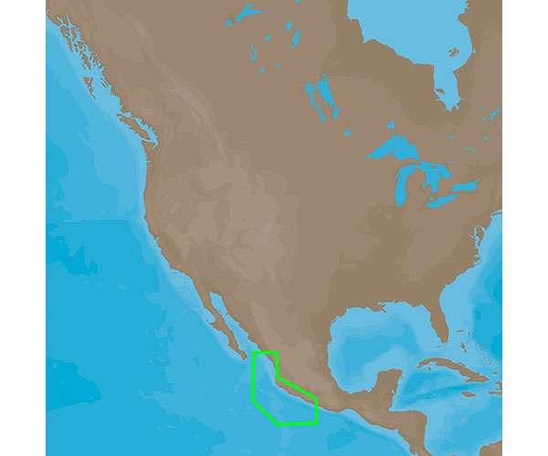
The C-MAP 4D Electronic Marine Charts represent the forefront of navigational technology, bringing to mariners a rich set of features and functionality that enhance the boating experience. These electronic charts stand out for their dynamic raster chart presentation, high-resolution satellite imagery, and full 3D views both above and below the water line, which can provide insight into the sea floor terrain and potential fishing hotspots. The NA-D949 chart specifically covers the stretch of the Mexican Pacific coast from Acapulco, MX to Mazatlan, MX, a popular region for both recreational and commercial mariners. This expansiveness ensures comprehensive navigational data is provided for this bustling seaway.
Key Features of the C-MAP 4D NA-D949:
- High-resolution satellite imagery, enhancing situational awareness.
- Dynamic raster charts that replicate the look of traditional paper charts.
- Insightful 3D views both above and below the waterline to help with understanding maritime terrain.
- Compatibility with a range of chartplotters including Furuno 1670F / 1870F, and Standard CPN 7000i, and CPN1010i units.
- Easy routing feature that suggests the safest path based on the vessel's draft, beam, and height.
- Updates on marina plans, tides, currents, and navigational aids.
- Vital details such as restricted areas, cable areas, and more for safe navigation.
This chart enhances the experience for recreational boating, sport fishing, and long-voyage sea travel by providing detailed and accurate nautical data within the specified coverage range. Whether you are island-hopping or on a commercial route, this chart is an indispensable tool for safe and efficient seafaring.
Frequently Asked Questions:
Q: What are the compatible units for the C-MAP 4D Electronic Marine Charts?
A: The C-MAP 4D Electronic Marine Charts are compatible with Furuno 1670F / 1870F, and Standard CPN 7000i, and CPN1010i units.
Q: What is the coverage of the NA-D949 chart?
A: The NA-D949 chart provides coverage from Acapulco, MX to Mazatlan, MX. This area encompasses critical maritime routes and popular sailing destinations within Mexican territorial waters.
Q: What additional features and specifications does the NA-D949 chart offer?
A: The NA-D949 chart is outfitted with numerous features intended to support seamless navigation and improve maritime safety. These features include but are not limited to dynamic chart views, detailed marina plans, and predictive data regarding tides and currents.
As navigational technologies evolve, so does the information available to mariners. The C-MAP 4D NA-D949 chart harnesses these technological advancements to offer a sophisticated and reliable aid that is essential for modern navigation.



Arsenio –
Tyla –
Shelly –
Cherice –
Rivka –