

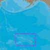
Embark on your next nautical adventure with confidence using C-MAP 4D Electronic Marine Charts, the cutting-edge in marine navigation. Boasting an unparalleled combination of detailed cartography and dynamic raster charts, these electronic marine charts are essential for any serious mariner planning to navigate the Hawaiian archipelago. With the NA-D963 chart, you will experience the freedom of the seas with a comprehensive suite of navigation tools at your fingertips.
Distinguished by its user-friendly features, the C-MAP 4D cartography system is seamlessly integrated with select marine electronics, including the Furuno 1670F / 1870F, as well as the Standard CPN 7000i and CPN1010i units. This ensures reliable and accurate navigation for both recreational and professional boaters. Whether you're sailing for leisure or managing marine operations, C-MAP 4D charts can enhance your maritime experience around the breathtaking Hawaiian Islands.
Enhanced Navigation with C-MAP 4D Features
With detailed marine chartography and an exhaustive database of maritime points of interest, C-MAP 4D charts arm you with all necessary information to navigate the Hawaiian Islands safely. The electronic charts promise dynamic updates, high-resolution bathymetric data, and the added convenience of creating personalized routes and waypoints.
C-MAP 4D charts are not just static navigation aids but living systems capable of evolving through updates. With the promise of future-proof navigation, these charts are an investment in your boating lifestyle, providing peace of mind that your routes will remain up to date with the latest available data.
Frequently Asked Questions About C-MAP 4D
In response to common queries from mariners and enthusiasts, please find below the answers to some of the frequently asked questions regarding the C-MAP 4D NA-D963 Hawaiian Islands chart:
1. Can I use the C-MAP 4D Hawaiian Islands chart with other marine units?
No, the C-MAP 4D Hawaiian Islands chart is designed to be compatible exclusively with selected marine units including Furuno 1670F / 1870F and Standard CPN 7000i / CPN1010i. It's vital to ensure your equipment supports C-MAP 4D technology to make the most of this advanced cartographic system.
2. What makes C-MAP 4D unique?
The standout feature of C-MAP 4D lies in its progressive update system. This innovative cartography leads the market by offering users the ability to integrate new data and services into their existing chart system ensuring ongoing accuracy and relevancy.
3. What are the additional features of C-MAP 4D?
C-MAP 4D charts exceed expectations with additional attributes that contribute to their usability and functionality. These features range from detailed cartography, progressive updates, and customizable navigation tools such as custom routes and waypoints, all designed to simplify maritime navigation and enhance overall safety at sea.
By familiarizing yourself with the capabilities of the C-MAP 4D NA-D963 Hawaiian Islands chart, you are setting the stage for unforgettable voyages around one of the world's most iconic and stunning marine destinations.


Lawson –
Daniela –
Nima –
Jessa –