C-MAP 4D Electronic Marine Charts are advanced navigation solutions that are designed to adapt to your boating needs. Unlike other digital charts, C-MAP 4D offers advanced features, and it allows users to add data and services as they become available.
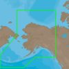
C-MAP 4D cartography is compatible with the Furuno 1670F / 1870F, and Standard CPN 7000i, and CPN1010i units. It provides comprehensive coverage of the southern Alaska coast from Dixon Entrance to Kodiak Island. Additionally, it includes all of the Aleutian Islands up to Attu Island, Bristol Bay, and the North Slope. It also extends over to Liverpool Bay in the Yukon Territory, Canada. Furthermore, it offers additional coverage of the MacKenzie River, all the way down to the 1160 km distance marker.
With C-MAP 4D, you can expect more features and specifications that enhance your navigation experience.
FAQs
What compatibility does C-MAP 4D have?
C-MAP 4D is compatible with the Furuno 1670F / 1870F, and Standard CPN 7000i, and CPN1010i units.
What is the coverage area of C-MAP 4D NA-D028 – Alaska?
C-MAP 4D NA-D028 – Alaska provides comprehensive coverage of the southern Alaska coast from Dixon Entrance to Kodiak Island. It also includes all of the Aleutian Islands up to Attu Island, Bristol Bay, and the North Slope. Additionally, it extends over to Liverpool Bay in the Yukon Territory, Canada, and offers additional coverage of the MacKenzie River.
Can I add data and services to C-MAP 4D?
Yes, C-MAP 4D allows users to add data and services as they become available.







Emilie –
Linzy –
Judd –
Caitlin –
Micky –
Kiersten –