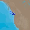
The C-MAP 4D NA-D956 is a cutting-edge electronic marine chart that revolutionizes the boating and navigation experience. Offering unparalleled detail and a comprehensive suite of features, C-MAP 4D ensures that mariners can traverse the waters from Victoria, BC to Cape Scott with confidence and ease. Its user-friendly technology is designed to be fully compatible with a range of marine electronics, providing boaters with the accurate and detailed information necessary for safe and efficient navigation.
Key Features of C-MAP 4D NA-D956:
- Full Coverage: Seamless navigation from Victoria, BC to Cape Scott.
- Compatibility: Perfectly integrates with Furuno 1670F/1870F, Standard CPN 7000i, and CPN1010i units.
- Dynamic Updatability: Ability to add data and services as they become available.
- Advanced Charting Technology: Utilizes the latest digital features for a superior navigation experience.
- Customizable Views and Details: Choose from different chart views for tailored navigation.
- 3D Views: Enjoy realistic 3D views of land elevation and underwater contours.
- Aerial Photography: Access high-resolution photos of harbors, marinas, and inlets to assist with docking and close maneuvering.
- Easy Routing: Automatic suggestions for the safest and most efficient paths to your destination.
- Marine Protected Areas: Contains valuable information on environmental zones to ensure compliance with regulations.
- Tides and Currents Data: Provides up-to-date tidal data and current information to assist in planning.
Frequently Asked Questions:
1. Which units are compatible with C-MAP 4D NA-D956?
The C-MAP 4D NA-D956 chart is compatible with select chartplotters, such as Furuno 1670F/1870F, Standard CPN 7000i, and CPN1010i units, ensuring a broad range of usability for boaters.
2. What is the coverage of C-MAP 4D NA-D956?
This chart offers extensive coverage, extending from Victoria, BC to Cape Scott, which is beneficial for boaters who want to completely explore and navigate the coastal waters of this picturesque area.
3. Can I add data and services to C-MAP 4D NA-D956 as they become available?
Indeed, the C-MAP 4D NA-D956 chart permits the addition of data and services post-purchase, helping users maintain an updated system with the latest navigational information.
4. How does C-MAP 4D enhance my boating experience?
C-MAP 4D offers a plethora of features that collectively enhance boating experiences, by providing advanced charting technology, dynamic 3D views, and detailed environmental data, allowing for a more informed and enjoyable time on the water.
Whether you are an experienced captain or an enthusiastic weekend cruiser, the C-MAP 4D Victoria, BC to Cape Scott – NA-D956 is a valuable tool designed to elevate your navigational capabilities and enrich your maritime adventures.






Billiejo –
Aviance –
Bruce –