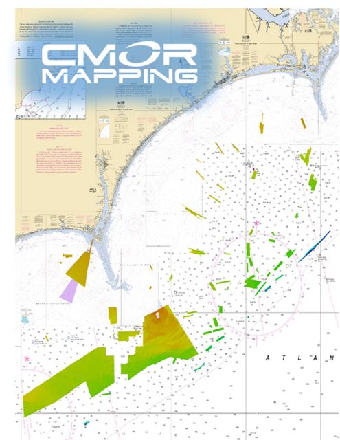
The depths in this region range from 50 to 150 feet, with some areas reaching up to 300 feet on the ledge. The data collected from the frying pan tower to the west towards Georgetown SC is organized in continuous blocks. This area is home to various wrecks and impressive natural features.
On the other hand, the data collected from the frying pan tower towards Cape Lookout consists of numerous smaller areas filled with wrecks, ledges, and interesting bottom features. These smaller spots often hold large concentrations of fish, but they are often overlooked due to their size.
The CMOR cards include NOAA Charts 11520, 11536, 11531, 11539, 11543, and 11544 as a background reference. They come on Micro SD cards and include a standard SD adapter for convenient use.
To use the CMOR cards, you will need a Raymarine device that supports the Lighthouse II or Lighthouse 3 interfaces. The device must have at least v17 software installed. Compatible devices include the Axiom Series, Axiom Pro, Hybrid Touch, aSeries, cSeries, eSeries, eS Series, gS Series, and Dragonfly Series.
Frequently Asked Questions:
1. Can I use the CMOR cards with any Raymarine device?
No, you will need a Raymarine device that supports the Lighthouse II or Lighthouse 3 interfaces. Compatible devices include the Axiom Series, Axiom Pro, Hybrid Touch, aSeries, cSeries, eSeries, eS Series, gS Series, and Dragonfly Series.
The depths in this region range from 50 to 150 feet, with some areas reaching up to 300 feet on the ledge.
The CMOR cards cover the offshore areas of Long and Onslow Bay, with a focus on the frying pan tower and its surrounding areas. The data collected from the frying pan tower to the west towards Georgetown SC is organized in continuous blocks, while the data collected from the frying pan tower towards Cape Lookout consists of numerous smaller areas filled with wrecks, ledges, and interesting bottom features.
4. What reference charts are included with the CMOR cards?
The CMOR cards include NOAA Charts 11520, 11536, 11531, 11539, 11543, and 11544 as a background reference.
5. What format are the CMOR cards available in?
The CMOR cards come on Micro SD cards and include a standard SD adapter for convenient use.




Adolphus –
Lacrisha –
Karilyn –