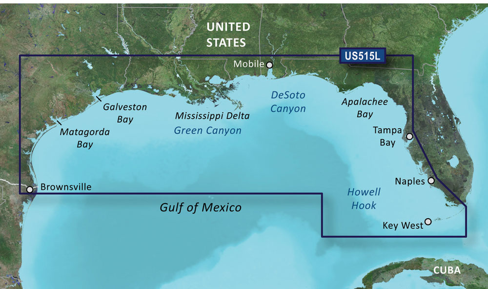
The BlueChart g3 Vision HD – VUS515L by Garmin provides boaters with extensive coverage of the Gulf of Mexico, including detailed information on Corpus Christi, Matagorda Bay, Galveston Bay, Port Arthur, Atchafalaya Bay, the Mississippi Delta, the Chandeleur Islands, Tampa Bay, and the Florida Keys west of Key Largo. The chart also features bathymetric coverage for offshore features such as DeSoto Canyon, Mississippi Canyon, and Green Canyon from Vernon Basin to Alaminos Canyon.
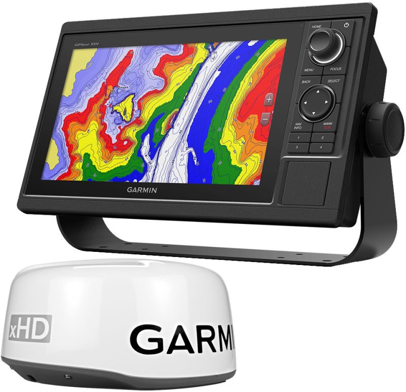
Garmin's Premier Coastal Navigation Charts deliver unmatched clarity and detail through updated coastal charts containing integrated Garmin and Navionics data. With Auto Guidance technology, the chart calculates and offers pathways, while high-resolution relief shading blends color and shadow to provide an enhanced view of the bottom structure. Depth Range Shading allows users to quickly see the target depth, while Shallow Water Shading identifies the depths to avoid in shallow waters. The chart provides superior situational awareness with high-resolution satellite imagery, giving comprehensive photographs of ports, marinas, bridges, and navigational markers.
Moreover, the BlueChart g3 Vision HD provides unique 3-D views, marine eye, and fisheye views, ideal for planning boats' future trips and exploring new areas. Nevertheless, it is essential to note that these features are solely for planning purposes and not for safe navigation operations.
Frequently Asked Questions about BlueChart g3 Vision HD – VUS515L
Q: What areas does the BlueChart g3 Vision HD – VUS515L cover?
A: The BlueChart g3 Vision HD – VUS515L covers the Gulf of Mexico, including Corpus Christi, Matagorda Bay, Galveston Bay, Port Arthur, Atchafalaya Bay, the Mississippi Delta, the Chandeleur Islands, Tampa Bay, and the Florida Keys west of Key Largo. It also includes bathymetric coverage for offshore features such as DeSoto Canyon, Mississippi Canyon, and Green Canyon from Vernon Basin to Alaminos Canyon.
Q: How does the Auto Guidance technology work?
A: The Auto Guidance technology calculates and offers pathways for boaters, helping them navigate through various waterways. This feature enhances safety and convenience by providing suggested routes based on the chart's data.
Q: What is the purpose of the relief shading feature?
A: The relief shading feature utilizes high-resolution blending of colors and shadows to provide boaters with a clearer and more detailed view of the bottom structure. It enhances the situational awareness and depth perception of the users, allowing them to navigate with greater confidence.
Q: What do Depth Range Shading and Shallow Water Shading do?
A: Depth Range Shading provides a visual representation of the target depth range, allowing boaters to quickly identify areas that meet their desired depth criteria. Shallow Water Shading, on the other hand, highlights shallow areas to avoid, ensuring a safer navigation experience.
Q: Are the 3-D views and marine eye/fisheye views suitable for safe navigation?
A: No, the 3-D views, marine eye, and fisheye views are meant for planning purposes and exploring new areas. They provide users with a unique perspective of the waterways, but should not be relied upon for safe navigation operations. It's always crucial to use the appropriate navigational aids and follow standard navigational practices when on the water.



Roscoe –
Johnell –