

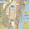
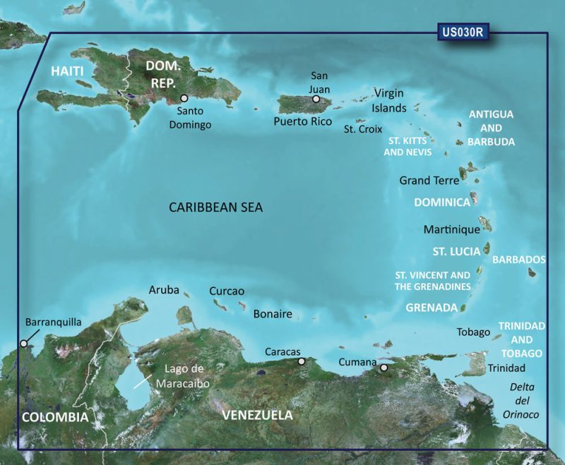
Explore the prime locations for exceptional crabbing tailored for kayakers with the Home Port Chart 20. Ideal for navigation and identifying superb crabbing spots, this chart spans the Great Egg Harbor Bay from Garden State Parkway to Mays Landing, encompassing the Tucahoe River from Lower Brothers Creek to the strategic points of Rte 50 and 557 in Tucahoe.
It is meticulously crafted, featuring corrected ICW Channels highlighted in yellow for enhanced visibility and navigation.
Key features of the Home Port Chart 20 include:
- Color-coded depth and contour curve lines, with pink denoting shallow areas of 6 feet or less
- Representation of holes and fishing grounds in the Back Bays
- Details of bridges and their vertical clearance at mean low water
- Identification of lighted markers, buoys, and day markers
- Marking of notable shore points and towns
- Laminated material for waterproof durability
- ICW Waterway distances in nautical miles between cities
- Locations of boat ramps and marinas
The chart is an essential tool for fishing enthusiasts keen on exploring local hotspots such as Crab Trap Slough, Robo's Hole, Mud Hole, Perch Grounds, The Elbow, The Pig Pen, Paddy's Hole, and many additional fruitful locations.
As a part of a comprehensive collection, the Home Port Chart 20 can be utilized along with other charts in the series to extend coverage and aid in planning extensive trips. Supplemental charts in this series include:
- #1 Delaware Bay
- #2 Beach Haven to Cape May to Indian River DE
- #6 “Mud Hole” Chart-Sandy hook to Ocean City NJ
- #7 Manasquan to Great Egg inlet out 20 miles
- #11 ICW Barnegat-Beach Haven-Atlantic City-Ocean City & Mullica River
Frequently Asked Questions
Below you'll find common questions about the Home Port Chart 20:
What does the color-coded depth and contour curve lines represent?
The color-coded depth and contour curve lines on the chart delineate different water depths, with pink specifically highlighting areas with a depth of 6 feet or less, which is especially relevant for shallow water navigation.
What additional information is included on the chart?
Aside from depth indications, the chart is replete with navigation-critical information like holes, fishing grounds, details of bridge clearances, and markers for safe and successful outings.
Is the chart waterproof?
Indeed, thanks to lamination, the chart is waterproof, enhancing its durability for use in various weather conditions.
What is provided in terms of boat ramps and marinas?
For boater convenience, boat ramps and marinas are clearly displayed on the chart, streamlining the process of finding access and docking locations.
Can this chart be used with other charts in the series?
Yes, the Home Port Chart 20 is designed to be interoperable, working in unison with other charts in the series for seamless and detailed navigational experience.


Keonna –
Mya –
Tanaya –
Everette –