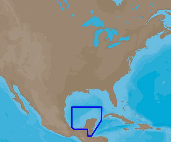
C-MAP 4D Electronic Marine Charts are an advanced navigation solution for boating enthusiasts. They offer a range of features and the ability to add new data and services as they become available. These charts are compatible with Furuno 1670F / 1870F, and Standard CPN 7000i, and CPN1010i units. The NA-947 chart covers the area from Coatzacoalcos, MX to Honduras Bay, GT. For more information on features and specifications, please refer to the documentation.
Frequently Asked Questions
What are the features of C-MAP 4D Electronic Marine Charts?
C-MAP 4D Electronic Marine Charts come with a variety of features designed to enhance your boating experience. These features include detailed cartography, tides and currents information, route planning and guidance, high-resolution satellite imagery, and more.
Which devices are compatible with the NA-947 chart?
The NA-947 chart is compatible with Furuno 1670F / 1870F, and Standard CPN 7000i, and CPN1010i units. It is important to ensure that your device is compatible before purchasing the chart.
Can I add new data and services to the C-MAP 4D charts?
Yes, C-MAP 4D charts allow you to add new data and services as they become available. This ensures that you always have the most up-to-date information for your boating journey.
What area does the NA-947 chart cover?
The NA-947 chart covers the area from Coatzacoalcos, MX to Honduras Bay, GT. This makes it a great choice for boaters planning to navigate in this region.



Marisol –
Jonathen –
Darrick –