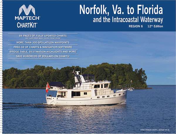
For generations, sailors and boaters have relied on Maptech ChartKit Books to navigate the waters with confidence. These essential nautical resources are packed with full-color reproductions of both U.S. government and private charts, carefully bound in a spiral format, easily integrating into any cruiser's journey along frequently traveled regions. This particular edition, the 12th, focuses on the crucial stretch from Norfolk to Florida and includes the Intracoastal Waterway, tailor-made for navigators seeking to travel this popular corridor with precision and ease.
The Maptech ChartKit boasts user-friendly features aligning with cutting-edge navigation technology. Not only are these charts gps-compatible, but they're also designed to seamlessly interface with today's sophisticated GPS systems, enhancing the sailing experience. You can expect meticulously plotted latitude and longitude grids, spaced at one-minute intervals, to pinpoint your vessel's location with accuracy unparalleled by traditional methods. In addition, strategically placed GPS waypoints name key navigation aids, simplifying the voyage planning process dramatically.
Diversity in charting is one of the Maptech ChartKit's strengths, providing a comprehensive portfolio of both small-scale, wide area and large-scale, detailed charts. These include thorough depictions of harbors and their approaches, ensuring that both a broad overview and minute details are at the navigator's fingertips. Quick navigation through the kit is facilitated by an intuitive Chart Page Index and user-friendly “Go-To” page numbers, making the search for the precise chart needed both swift and stress-free for busy mariners.
Practical aspects of navigation are not neglected, as the ChartKit encompasses pre-plotted magnetic courses among major navigation beacons. These plotted courses, denoted with distances in nautical miles, offer a reliable guide for plotting your journey. For those who tailor their courses, the inclusion of a compass Rose on each page—featuring the annual variance increase and comprehensive scale data—allows for custom course calculation, pivotal for personal journey adaptations.
One of the unique offerings within the Maptech ChartKit is the provision of vibrant aerial photographs. These color photographs provide invaluable visual cues about harbors and anchorages, equipping you with pre-arrival insights and enabling informed decisions about navigation and anchorage choices.
To bridge the gap between traditional and digital navigation, the Maptech ChartKit heralds a companion CD. This digital asset is laden with digital charts, mirroring the detail and quality of the printed charts within the actual Chartbook. Enriched with vital GPS waypoints and course lines, and coupled with the requisite software tools, your digital navigation needs are comprehensively covered, consistent with the analog experience.
Frequently Asked Questions (FAQs) about Maptech ChartKit
Q: How do the GPS features enhance the Maptech ChartKit's usability?
A: GPS features transform the Maptech ChartKit into a dynamic navigation tool, working in concert with your onboard GPS system. With precise one-minute latitude and longitude grids and clearly marked GPS waypoints, your navigation becomes a process of utmost precision and ease.
Q: What types of charts are included for coastal and harbor navigation?
A: Alongside its versatile range, the ChartKit covers an expansive array of maritime environments, including both small-scale charts for broader coastal areas and high-precision, large-scale charts for intricate harbor and approach navigation. Together, they provide a complete picture of your sailing terrain, ensuring you are well-equipped for every segment of your journey.
Q: Can I chart my own navigational courses with Maptech ChartKits?
A: Absolutely. Beyond the pre-plotted courses, you are empowered to chart your own path with tools such as the Compass Rose and its accompanying variance data, allowing for meticulous, personalized course plotting tailored to your unique expedition.
Q: What is the role of aerial photos in the Maptech ChartKit?
A: Aerial photos serve as visual aids, granting you a bird's-eye view of prospective harbors and anchoring spots. This foresight is critical for planning safe and smooth arrivals, anchorage selection, and to give you a heads-up on the local geography before making landfall.
Q: Do the Maptech ChartKits include digital charting options?
A: Yes, the digital companion CD in the Maptech ChartKit enriches your navigation toolkit with identical digital versions of the chartbook's charts. These are loaded with interactive features such as GPS waypoints and course lines, geared towards modern digital plotting devices, ensuring a seamless transition between traditional and electronic navigation methods.
By providing this level of granularity and attention to detail, the Maptech ChartKit: Norfolk – Florida & Intracoastal Waterway, 12th Ed. stands out as a foundational resource for boaters and sailors charting their course along this bustling marine highway. Sailors looking to purchase this indispensable ChartKit can easily find it online or at nautical supply stores—a cornerstone investment for both seasoned mariners and enthusiastic novices embarking on their waterborne adventures.




Serene –
Danya –
Landon –
Phong –
Sharisse –
Evangeline –